Ancient food in the Merzouga Region of Morocco. Merzouga is a small Moroccan town in the Sahara Desert, near the Algerian border. It’s known as a gateway to Erg Chebbi, a huge expanse of sand dunes north of town. West of Merzouga, Dayet Srji is a seasonal salt lake that’s often dry in summer. When full, it attracts a wide range of migratory and desert birds, including desert warblers, Egyptian nightjars and, occasionally, flamingos.
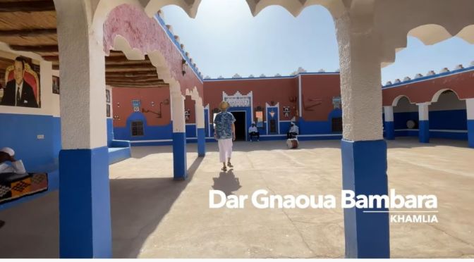
Restaurants: Dar Aytma Restaurant and Dar Gnaoua Bambara.
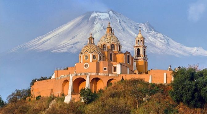
@Eva zu Beck takes you on a journey to Cholula and Puebla, two cities in central Mexico designated as Pueblos Mágicos, or Magical Towns. These are places that offer visitors a very special experience, owing to their typical historic character and in some cases, colonial-era architecture. As well as a spectacular pyramid and a miniature volcano, the towns are a great place to experience the Danza de los Voladores, or Dance of the Flyers.
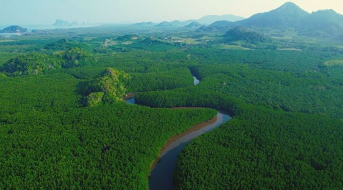
Trang, also called Mueang Thap Thiang, is one of the southern provinces (changwat) of Thailand, on the west side of the Malay Peninsula facing the Strait of Malacca. Neighboring provinces are (from north clockwise) Krabi, Nakhon Si Thammarat, Phatthalung, and Satun.
Trang was formerly a port involved in foreign trade. It was the first place where rubber was planted in Thailand. Phraya Ratsadanupradit Mahison Phakdi brought rubber saplings from Malaya and planted them here in 1899, and rubber is now an important export of the country. The Trang River flows through the province from its origin in the Khao Luang mountain range, and the Palian River flows from the Banthat mountains. The province of Trang has an area of approximately 5,000 square km and 199 km of Strait of Malacca shoreline.
All over Turtle Island—a common Indigenous name for North America—its original inhabitants are reclaiming a status that they have never surrendered. pic.twitter.com/nxeRLWiY1j
Horsepower is making a comeback in vineyards across France as wine growers look for more ecological ways to operate. Not only does using horses instead of tractors help reduce CO2 emissions, the animals are also more precise and better for the soil, say converts.
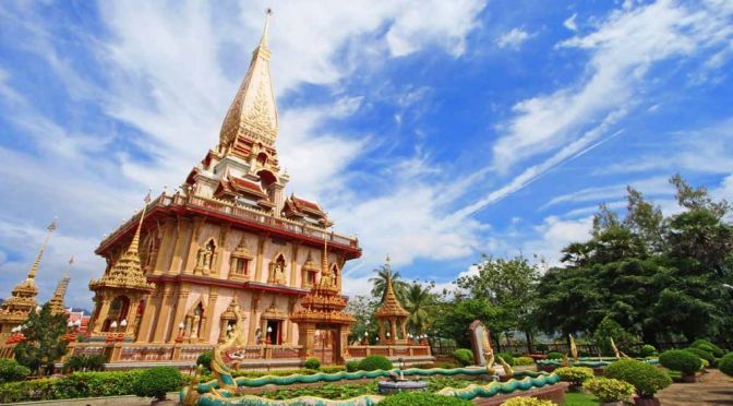
Wat Chalong is a historical landmark and Buddhist temple in Phuket’s Chalong Bay. For centuries, locals come to pray almost every day while westerners learn about Buddhism during their vacation. It’s officially called Wat Chaitararam, but most people refer to it by Wat Chalong. The temple is located on Chao Fa West Road in the northern part of Tambol Chalong.
Many locals claim that the temple often experiences many miracles. It’s also known for its pivotal and healing role in the fighting between Chinese secret societies (Angyee) in 1876.
“Sunday Morning” leaves us with wild horses along the Outer Banks near Corolla, North Carolina. Videographer: Carl Mrozek.
The Corolla Wild Horses are located in the northernmost beaches of the Outer Banks, in the 4WD area that’s just north of Corolla. Wild horses, also known as Wild Ponies, are also found on Ocracoke Island, and can be viewed at the Ocracoke Pony Pen just south of the Hatteras / Ocracoke ferry docks.
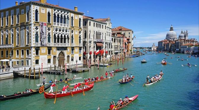
The Vogalonga is a non-competitive celebration for all rowers. This peaceful protest against wave damage caused by motor boats, and lagoon degeneration, brings together Venetians and enthusiasts from around the world.
The naval review Vogalonga is held, yearly, in Venice on the Pentecost Day. The Vogalonga which started in 1975 by the local rowing clubs as a protest against the wash and the waves created by the ever increasing number of motor boats in the city and the lagoon. More than 400 boats in various kinds and sizes from 50 Venice’s clubs and private boats from all over the world participate in this wonderful event.
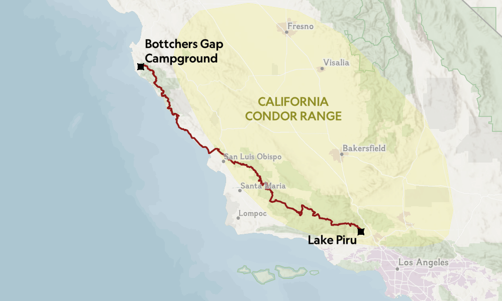
California’s Condor Trail winds through seven wilderness areas, rewarding intrepid hikers with spectacular nature—and even a glimpse at its endangered namesake https://t.co/AayUZlur5x
The rugged chaparral of California’s Sespe Wilderness lay hidden under the camouflage of mahogany and sage hues. Nearly a week into her thru-hike on the Condor Trail, Brittany Nielsen surveyed this scraggly landscape. She had already faced a downpour, severe flooding, and hypothermia. Now, she leaned against her pack in the spring sun, scanning the thickets and hoping the trail would emerge like a scrub jay.
“I learned a lesson about being calm while being lost on the trail,” Nielsen says. Earlier, behind on miles and low on her food supply, she had searched for the path in a frenzy, only to find herself exhausted. The trail on the side of Sespe Creek was fiercely overgrown in sections and required strong orienteering skills to navigate.
“When I opened my eyes I was looking at the sky,” Nielsen says, “And up above me—I couldn’t believe it—there was a condor.” She noted the telltale band of white feathers in the shape of a scalene triangle that decorated the bird’s nine-foot wingspan. When the condor drifted out of sight, Nielsen dropped her gaze into the chaparral where, directly in front of her, she discovered a small rock cairn that marked the trail.
Over the course of her 37 days on the hike, Nielsen would lose and gain the trail numerous times as she fought through menacing brush and screamed expletives that no one could hear in the most remote pockets of Los Padres National Forest. She would travel through seven wilderness areas, along the shores of central California, past colonies of elephant seals, and across the ancestral lands of the Chumash, Salinan, Esselen, Tataviam, and Costanoan peoples.
SOURCES: BRYAN CONANT; IUCN REDLIST
Unlike California’s well-established John Muir and Pacific Crest Trails, the Condor Trail is a thru-hiking “route,” meaning its course exists—as a continuous thread of trails and roads and cross-country travel—but that it lacks proper signage and maintenance. While these popular thru-hiking routes receive hundreds of hikers a year, Nielsen took on the Condor Trail alone in 2015. When she finished on June 18th, she was the first thru-hiker to complete it.
News, Views and Reviews For The Intellectually Curious