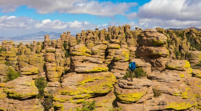
Join ranger Theresa Ferraro as she talks about the history, people, and geology of Chiricahua National Monument—located in one of Arizona’s seven sky islands.
Chiricahua National Monument is a unit of the National Park System located in the Chiricahua Mountains of southeastern Arizona. The monument was established on April 18, 1924, to protect its extensive hoodoos and balancing rocks.
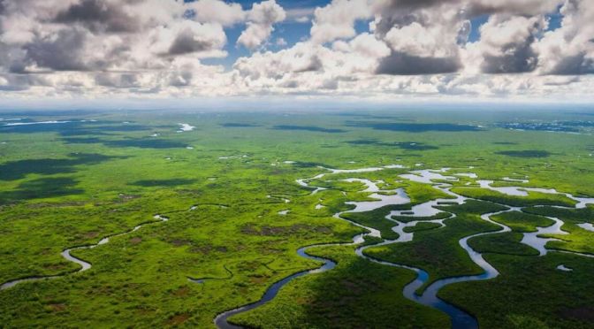
The Everglades is a water world — It’s the widest and slowest river in the United States. But in the heart of this great water body exist secret islands that have outsize importance for the cultural heritage of a people and for the biodiversity of this important wetland. Thousands of these tree islands dot the Everglades.
For generations, the Miccosukee people have called these islands home. And they’ve long understood that the islands are a giver of life in this unforgiving environment. The islands are some of the only dry land around and harbor a surprising diversity of plant and animal life, including: coyotes, bobcat, bear, and even the Florida panther.
But among the scientific establishment, the islands are little understood. Researchers from the Miccosukee tribe are working to understand how animals use the islands and what role they play in the larger Everglades ecosystem. With the islands under threat from outside forces, their studies have taken on increased urgency. What they’re finding could be key to preserving the Miccosukee culture and the balance of life in this great river.
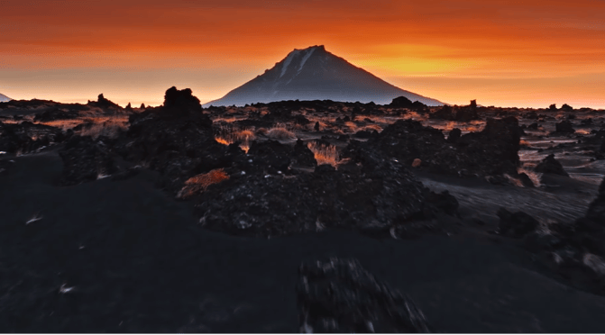
Kamchatka Peninsula, also spelled Kamčatka, Russian Poluostrov Kamchatka, peninsula in far eastern Russia, lying between the Sea of Okhotsk on the west and the Pacific Ocean and Bering Sea on the east. It is about 750 miles (1,200 km) long north-south and about 300 miles (480 km) across at its widest; its area is approximately 140,000 square miles (370,000 square km).
Two mountain ranges, the Sredinny (“Central”) and Vostochny (“Eastern”), extend along the peninsula and rise to 15,584 feet (4,750 metres) in Klyuchevskaya Volcano. The trough between these mountain chains is occupied for much of its length by the Kamchatka River. Of the 127 volcanoes, 22 are still active, as are a number of geysers and hot springs. Most of the active volcanoes lie along a fault line on the eastern flank of the Vostochny Range.
The western coastlands of the Kamchatka Peninsula form a low plain crossed by many rivers and with extensive swamps, while the eastern coast is an alternation of broad gulfs and cliffed, mountainous peninsulas. A small geothermal-power station uses underground steam and is in operation near the southern end of the peninsula.
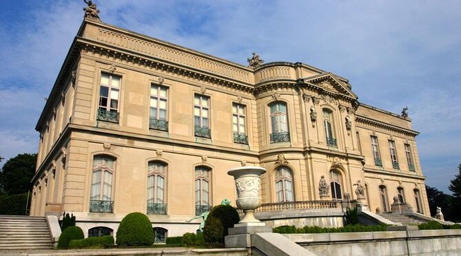
The Elms was the summer residence of Mr. and Mrs. Edward Julius Berwind of Philadelphia and New York. Mr. Berwind made his fortune in the coal industry. In 1898, the Berwinds engaged Philadelphia architect Horace Trumbauer to design a house modeled after the mid-18th century French chateau d’Asnieres (c.1750) outside Paris.
Construction of The Elms was completed in 1901 at a cost reported at approximately $1.4 million. The interiors and furnishings were designed by Allard and Sons of Paris and were the setting for the Berwinds’ collection of Renaissance ceramics, 18th century French and Venetian paintings, and Oriental jades.
The elaborate Classical Revival gardens on the grounds were developed between 1907 and 1914. They include terraces displaying marble and bronze sculpture, a park of fine specimen trees and a lavish lower garden featuring marble pavilions, fountains, a sunken garden and carriage house and garage. These gardens were recently restored.
Mrs. Berwind died in 1922, and Mr. Berwind invited his sister, Julia, to become his hostess at his New York and Newport houses. Mr. Berwind died in 1936 and Miss Julia continued to summer at The Elms until her death in 1961, at which time the house and most of its contents were sold at public auction. The Preservation Society of Newport County purchased The Elms in 1962 and opened the house to the public. In 1996, The Elms was designated a National Historic Landmark.
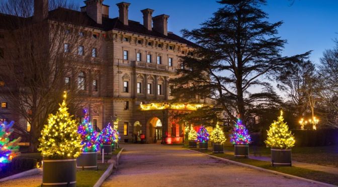
A short tour of The Breakers in Newport, Rhode Island in mid-December, 2021. The Breakers, which is owned by the Preservation Society of Newport County, is the “grandest of Newport’s summer ‘cottages,'” as the Preservation Society puts it on their website, and I personally thought it lived up to that.
The Breakers is the grandest of Newport’s summer “cottages” and a symbol of the Vanderbilt family’s social and financial pre-eminence in turn-of-the-century America.
Commodore Cornelius Vanderbilt (1794-1877) established the family fortune in steamships and later in the New York Central Railroad, which was a pivotal development in the industrial growth of the nation during the late 19th century. The Commodore’s grandson, Cornelius Vanderbilt II (1843-1899), became Chairman and President of the New York Central Railroad system in 1885, and purchased a wooden house called The Breakers in Newport during that same year.
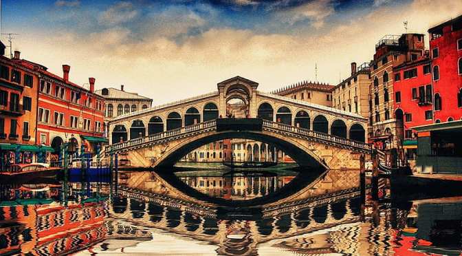
The Rialto bridge is one of the four bridges, together with the Accademia bridge, the Scalzi bridge and the Constitution bridge, that cross the Grand Canal, in the city of Venice. Of the four, the Rialto bridge is the oldest. According to the chronicles, the first passage on the Grand Canal consisted of a bridge of boats.
The growing importance of the Rialto market, on the eastern bank of the canal, increased the traffic on the floating bridge. Around 1250, it was replaced by a wooden bridge. In the first half of the 15th century, two rows of shops were built along the sides of the bridge; the proceeds from the rents, collected by the State Treasury, contributed to the maintenance of the bridge.
In 1310 the bridge was damaged during the retreat of the rioters led by Bajamonte Tiepolo. In 1444, however, it collapsed under the weight of the large crowd gathered to witness the passage of the procession of the bride of the Marquis of Ferrara. In 1503 the construction of a stone bridge was proposed for the first time.
In the following decades, several projects were evaluated. The work was completed in 1591, with the help of the architects Antonio and Tommaso Contin, who were his nephews, as sons of his son-in-law Bernardino Contin.
Utah is a state in the Mountain West subregion of the Western United States. Utah is a landlocked U.S. state bordered to its east by Colorado, to its northeast by Wyoming, to its north by Idaho, to its south by Arizona, and to its west by Nevada. Utah also touches a corner of New Mexico in the southeast.
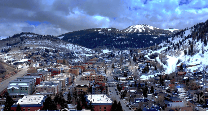
Video timeline: 0:00 1. Salt Lake City skyline at sunset with mountains behind 0:08 2. Park City Mountain Resort, Utah 0:16 3. Utah mountain landscape 0:22 4. Park City Mountain Resort 0:30 5. Horses at Zion National Park 0:38 6. Road through the desert and mountains of Utah 0:47 7. Amazing rock formations in Utah 0:56 8. Salt Lake City at night 1:03 9. Amazing rock formations in Utah 1:11 10. Utah Arches National Park on a sunny day 1:18 11. Stormy desert buttes and river near Moab, Utah 1:26 12. Butte landscape, Utah 1:34 13. Salt Lake City, Utah 1:40 14. Pink cliffs in Snow Canyon State Park, Utah 1:49 15. Salt Lake City capital building 1:57 16. Stunning red sandstone hoodoos in Bryce Canyon National Park 2:07 17. Colorado river highway 128, Utah 2:18 18. Salt Lake City skyline and cathedral 2:29 19. The Mars Desert Research Station (MDRS) in Utah 2:36 20. Colorado river highway 128, Utah 2:46 21. Sunny dry desert towards big rocky mountains and clear blue sky in Utah 2:55 22. Salt Lake City capitol building city skyline 3:03 23. Peaceful reflective water between canyons in Lake Powell 3:13 24. Salt Lake City Assembly Hall from Latter-day Saints 3:23 25. Mountain landscape in Utah 3:42 26. Cliff edge in Southern Utah 3:48 27. Utah Arches National Park at sunrise 3:58 28. Lake Powell rock formations and canyon walls 4:10 29. Salt Lake City skyline at sunset with mountains 4:20 30. Butte factory in Utah 4:30 31. Mexican Hat rock formation in Utah 4:41 32. Red Rock Mesa mountain cliffs in Red Rock desert, Utah 4:48 33. Utah Arches National Park on a sunny day 5:02 34. Lake Powell with canyons in the background 5:13 35. Salt Lake City capitol building 5:25 36. The Mars Desert Research Station (MDRS) in Utah 5:34 37. Utah mountain landscape 5:50 38. Winding road leading to unique Bears Ears, Utah 6:01 39. Rock formations in Paria, Utah 6:12 40. Texas Gulf Potash Pond One in Utah 6:28 41. Juniper trees in a vast desert in Central Utah 6:35 42. Red rock buttes and cliffs in Utah 6:49 43. Colorado river in the desert, Utah 7:04 44. Salt Lake City, Utah 7:27 45. Road in beautiful desert, Burr Trail canyon 7:33 46. Antelope Island, Utah 7:47 47. Empty desert road at sunrise in Monument Valley, Utah 7:59 48. Stunning red sandstone hoodoos in Bryce Canyon National Park 8:14 49. Utah Arches National Park on a sunny day 8:20 50. The Mars Desert Research Station (MDRS) in Utah 8:34 51. Utah Arches National Park at sunrise 8:41 52. Texas Gulf Potash Pond One in Utah 8:58 53. Utah Arches National Park at sunrise 9:06 54. Grand Canyon at Utah border 9:20 55. Rock formations in Paria, Utah 9:39 56. Famous sunny American desert highway road in Monuments Valley 9:53 57. Salt Lake City, Utah
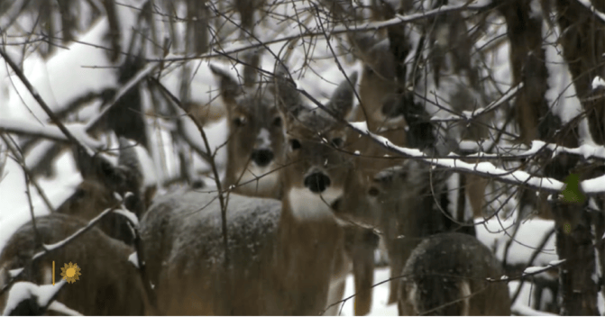
“Sunday Morning” takes us to Newton Hills State Park in eastern South Dakota, where they are getting a head start on a white Christmas. Videographer: Kevin Kjergaard.
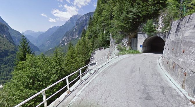
Sella Nevea, at an altitude of 1,195 m, is a high mountain pass in the Julian Alps, in the Friuli-Venezia Giulia region of northeast Italy. Sella Nevea also lends its name to a frazione of the Chiusaforte municipality and the nearby Kanin-Sella Nevea Ski Resort.
News, Views and Reviews For The Intellectually Curious